![]()
Sasbye om lystårnet - Sasbye about the light tower Updated: 20 DEC 2013
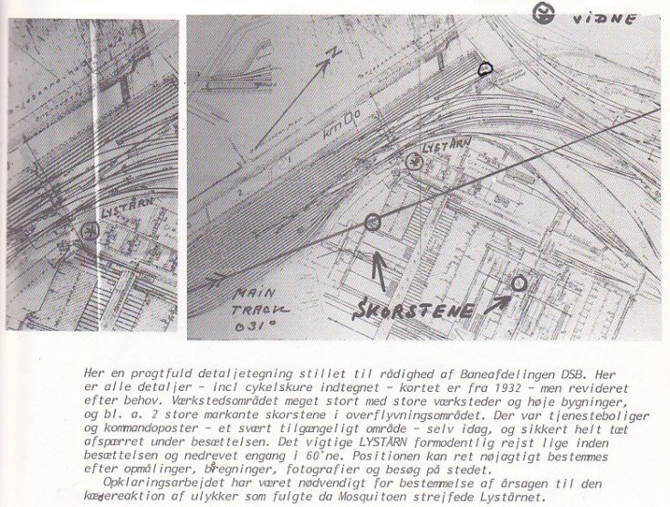 ned efter en kollision. Mere om Lystårnet fra et fly Lystårnet ramt af MOS SZ977 Position for lystårn her Udsigt fra lystårn 35 m højt. Nedrevet efter 1966. DSB-foto 1955 Ændret lidt siden 1945! Kjeld Mahler Sasbye har i Operation Carthage denne tegning fra DSB. Positionen er ikke LYSTÅRN men i cirklen halvvejs mod VIDNE. Se indflyvningsretningen med sydvest- hjørnet her af Sct. Jørgens Sø som sidste checkpunkt inden Shellhuset. Se Google Map Shellhuset og kort. after a collision. See The light tower from the air The light tower hit by MOS SZ977 Position of light tower here View from the light tower 35 m tall. Demolished after 1966. DSB photo from 1955. Some changes since 1945! Kjeld Mahler Sasbye has in Operation Carthage this drawing from the DSB. The position is not LYSTÅRN but in the circle halfway to VIDNE. Google Map Shell House and Map. See the run in with the south west corner here of Sct. Jørgen's Lake as the final checkpoint before the Shell House. |