  LAN R5679
styrtede ned
her,
tæt på
her, overblik
her.
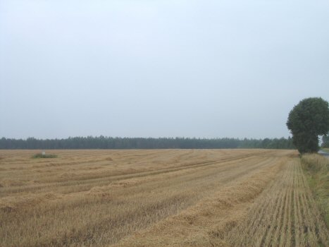
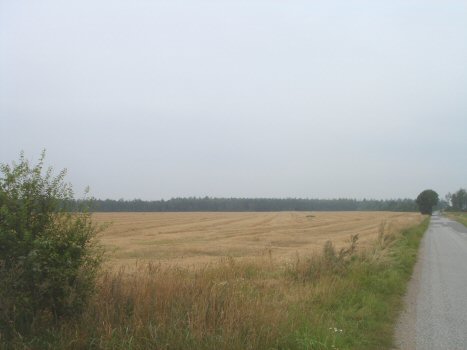
Den 8. oktober 2012 fandt vi
LAN R5679
styrtede ned
her,
tæt på
her, overblik
her.
Den 8. oktober 2012 fandt vi
med metaldetektorer vragrester på netop dette sted bag det sydvestlige
hjørne af denne
mark vest for
Resenfeldevej 17,
7470 Karup udpeget af Kirstine Filbert og Kurt Mikkelsen.
Nedstyrtningsområdet er bag venstre kant af marken på de to øverste fotos.
Se Attrap.
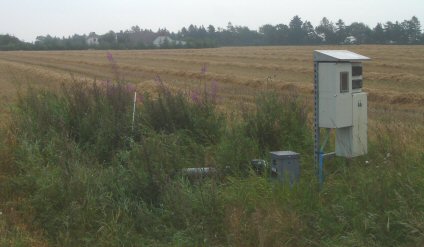
Foto nederst viser markvandingsbrønden, der også ses på de to andre fotos.
I baggrunden ses Resenfeldevej 17.
Foto øverst til højre er set fra indkørsel til gården.
Se også
Himlen lyste op, da bombeflyet brændte *
En flyver *
Grønhøj Kro.
 LAN R5679
crashed
here,
at close range here,
overview
here. On 8 October 2012 LAN R5679
crashed
here,
at close range here,
overview
here. On 8 October 2012
we found, with metal detectors, pieces of wreckage on the spot behind the
south west
corner
of this field west of
Resenfeldevej 17, 7470 Karup.
Kirstine Filbert and Kurt Mikkelsen had pointed out the place to us.
See also Decoy Airfield Grove/Karup.
The crash site area is behind the left corner of the field in the photos at
the top of this page.
The photo at the bottom shows the well for
irrigation
also seen in
the other photos.
Resenfeldevej 17 is seen in the background. The top right photo is seen from
the farm.
See also
the article The sky lit up when the bomber burned
*
One airman *
Grønhøj Kro |